Guest Post: Supriya Kelkar on Strong as Fire, Fierce as Flame
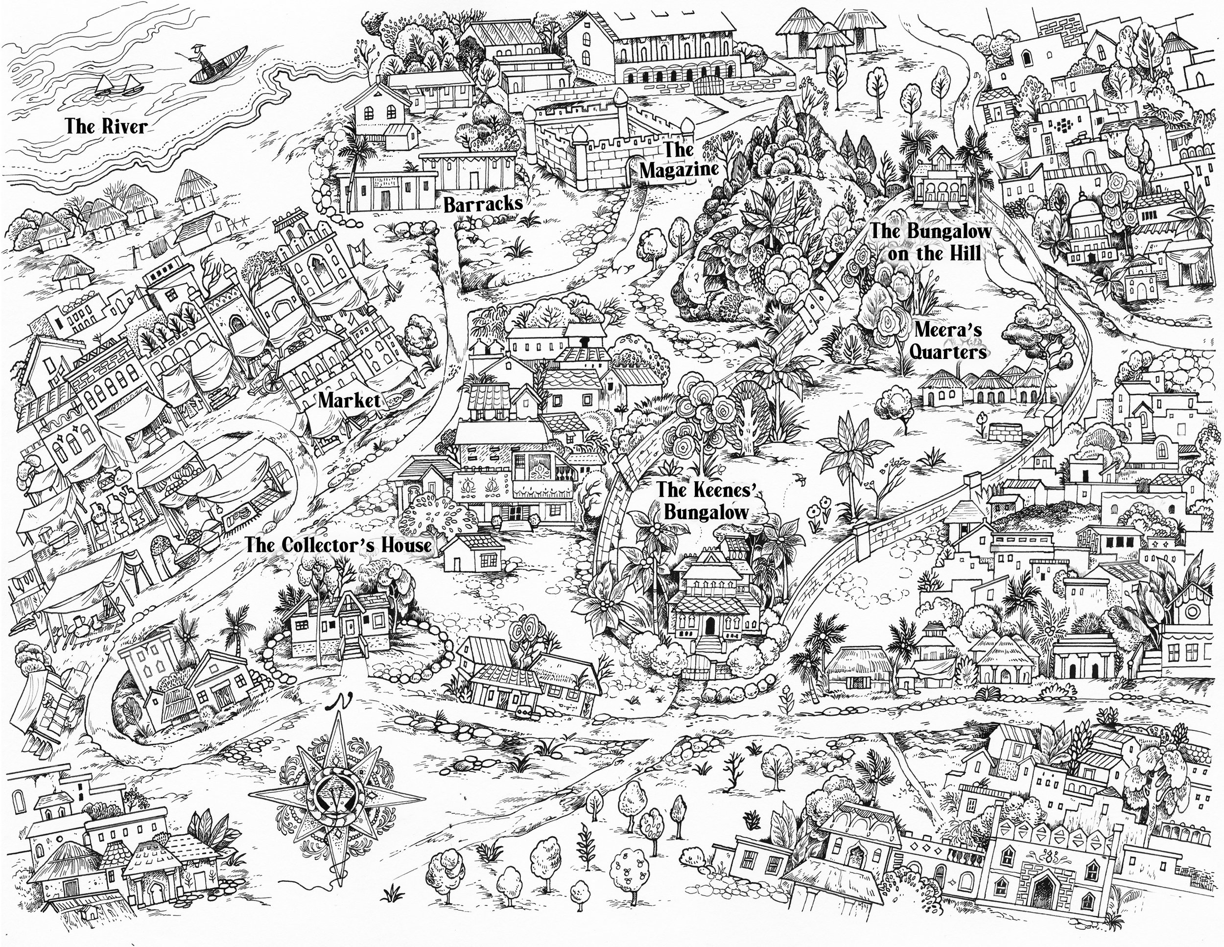
Final art by Vikki Zhang: Map of Indranagar, from Strong as Fire, Fierce as Flame by Supriya Kelkar. Image courtesy of Tu Books/Lee and Low
A densely drawn map will lure me into a book anytime, and this one worked its magic. The backdrop to the story is 1857, the year that Indian troops rebelled against the East India Company, the world’s first multinational, which had occupied large territories in India, taxed local people, and maintained a standing army.
The map is from the front matter of a middle grade historical novel from Tu Books/Lee and Low, Strong as Fire, Fierce as Flame. A Jane Addams Honor book, it’s also a 2021-22 Read Across America selection and a 2022 Global Read-Aloud Choice for middle school. I asked author Supriya Kelkar to tell me more about how she visualized her fictional 19th century Indian town of Indranagar. Here’s what she wrote:
When I was creating the fictional town in Ahimsa, it was easy for me to imagine it. I just set it on my father's hometown of Ahmedabad, and made sure everything in it was like the still-standing buildings from the 1940s. I also had the luxury of double-checking everything with my dad.
But when it came time to write about the fictional town of Indranagar in Strong as Fire, Fierce as Flame, it was a lot harder. Strong as Fire, Fierce as Flame is set almost 100 years before Ahimsa. There are no living sources to check accuracy with. So I had to go about creating this town differently to ensure it worked for both the plot and was historically accurate.
To start, I referenced old paintings and historical books from that era. These books, written by colonizers from the 1600s-1800s, given to me by a professor, were difficult to read, full of racist depictions of Indians and South Asians and their diverse cultures, religions, and languages. But in the sketches in them, I found images of barracks, sepoys, bungalows, and bazaars from that era. These helped me imagine the spaces my characters were going to move through. I knew the bungalow would be full of areas where Meera could witness how very different her colonizers’ lives were from her own. I knew the town would have places where Meera would witness injustices and rebellion and would learn to find her inner fire.
Once I had all the details down, it was time for me to draw a map. I needed a reference that I could look at any time I was writing about what directions characters go in to get to places that are so pivotal to the plot like the baazaar, the magazine, the river, the Keene estate, and the bungalow on the hill.
I often tell kids during school visits that drawing a map is one of the most helpful tools I use when creating a fictional town or land. It helps me visualize my setting and keep things straight.
I was thrilled when my editor, Stacy Whitman, at Tu Books, suggested we include a map in the book. It was illustrated by Vikki Zhang and designed by Sheila Smallwood, and I love hearing how readers use it to get their bearings while reading Strong as Fire, Fierce as Flame.
Maps can be tools for exploratory work. They can help us keep the spatial characteristics of our settings in mind as we create drafts. They can even help in revision. Congratulations Supriya, on the creation of this fictional town in the vivid historical world of your book!

